


Road Pad app for iPhone and iPad
Developer: Neil Beaver
First release : 19 May 2011
App size: 8.92 Mb
Turbocharge your lesson briefings with Road Pad, the ultimate tool for driving instructors!
Road Pad helps you create your own personal teaching aids, perfectly tailored to your local area and your way of teaching. Use Road Pad to:
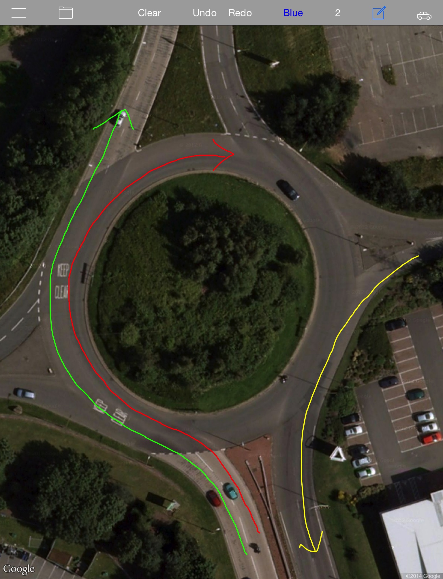
• View a satellite image of any road or junction and use the built-in drawing tool to illustrate the image and instruct your pupil.
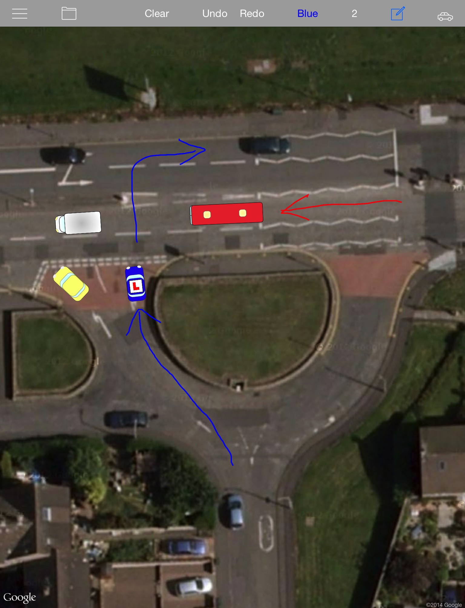
• Add road users to the screen and position them to re-create real life situations.
• Save your most commonly used images so they can be retrieved immediately, even when your network connection is slow or unavailable.
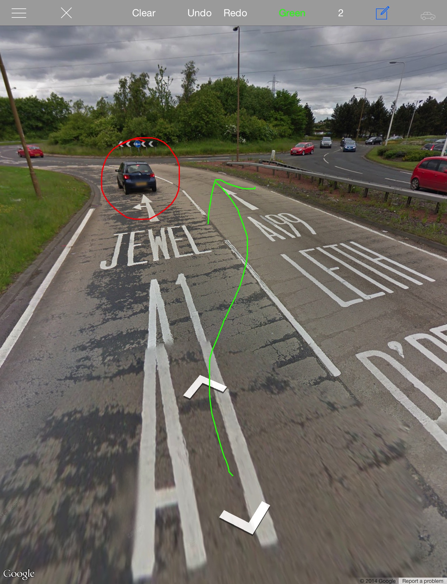
• Display and draw on any image from your iPads photo library.
• Help your pupils to learn exactly what they should be doing in any given situation.
• Also provided is a blank drawing pad so you can easily illustrate anything that comes to mind.
How it works:
Your pupil has just made a dogs breakfast of a large roundabout. You pull over to the side of the road and open Road Pad. Select the satellite view and tap the location button. Road Pad will zoom in on your current position. Then simply pan the image over the roundabout, tap the draw button, and start illustrating how it should be done. Its that easy! If there are particular roads or junctions you find you need to illustrate regularly, these can be cached in your library for quick retrieval - regardless of network availability.
Please be aware: NO GUARANTEES CAN BE MADE ABOUT THE QUALITY OR RESOLUTION OF SATELLITE IMAGES IN YOUR AREA.
Location services and ability to download satellite images are dependent on a suitable network connection being available.